Why some of Europe’s most important railway stations are not its most important cities
If there is one thing that becomes clear when spending time with railway timetables, it is that certain place names appear again and again. Some are obvious major cities, others are far less familiar, yet they recur with remarkable frequency across international and domestic services alike.
The explanation is rarely the same. In some cases, importance is inherited from geography. In others it is the result of deliberate railway planning. Elsewhere, it reflects historical borders that no longer exist in the same form. Taken together, these places reveal something fundamental about how railway networks actually function.
Crewe — the archetypal railway town
If there is an archetypal railway town in Britain, it is Crewe.
Before the arrival of the railway, it was little more than a small Cheshire township. The decision by the Grand Junction Railway to establish locomotive works there in the 1840s transformed the settlement, and it rapidly grew around the railway thereafter.
Yet the reason Crewe remains important today extends beyond its origins as a railway town. Unlike Basel, Villach or other European railway crossroads, its significance owes comparatively little to geography. Instead, it reflects a succession of decisions made by railway companies over almost two centuries. Routes converged there, connections were organised there, and generations of travellers became accustomed to changing trains there.
In this sense, Crewe demonstrates how railway geography can become self-reinforcing. Once a place acquires importance within the network, there are often good reasons for retaining that role. Many passengers know Crewe only as a station seen from the train window, yet few places have had a greater influence on the way Britain’s railways developed.
Basel — geography and borders
If Crewe illustrates how railway importance can be created, Basel demonstrates the opposite. Here, geography did most of the work long before the first train arrived.
Situated at the meeting point of Switzerland, France and Germany, Basel has long occupied a strategic position on routes linking northern Europe with the Alpine world. Trade and travel naturally flowed through the city, and when the railways arrived they largely followed these established corridors.
As a result, Basel became one of Europe’s principal international railway gateways. Trains between Switzerland and France, Germany and beyond converge there, making it a familiar name to timetable readers despite not being Switzerland’s capital or largest city.
Many long-distance German services also begin or terminate at Basel, with frequent trains to destinations such as Berlin and Hamburg reinforcing its role as a major node in the wider network.
Unlike Crewe, whose importance reflects a succession of railway decisions, Basel’s significance stems from a geographical position that railway planners could scarcely ignore. The trains came because the routes already pointed that way.
Břeclav — the legacy of an empire
If Basel represents geography, Břeclav illustrates the enduring influence of history.
Today the town sits close to the borders of the Czech Republic, Slovakia and Austria, making it appear to be a natural international railway crossroads. Yet its importance predates those borders. Much of the network converging on Břeclav was developed during the nineteenth century, when these territories formed part of the Austro-Hungarian empire.
Routes towards Wien, Praha, Bratislava, Budapest and Kraków were planned as components of a single railway system serving the political, economic and military needs of the Austro-Hungarian empire. When the empire disappeared in 1918, the new international borders cut across an existing railway network. Although the political map of Central Europe changed dramatically, the railways remained largely in place.
As a result, Břeclav continues to occupy a position in the timetable that far exceeds the size of the town itself. The empire disappeared, but the railway geography it created remained.
Arth-Goldau — engineered connectivity
If Břeclav reflects history, Arth-Goldau shows how railway importance can emerge from network design within constrained geography.
At first glance it is an unassuming settlement in central Switzerland. Yet its station is a key node in the Swiss railway system, sitting at the point where routes through the Gotthard axis connect with services towards Zürich, Luzern and central Switzerland.
Unlike Basel, which functions as an international gateway shaped by borders, Arth-Goldau owes its importance to the structure of the Swiss network itself. Mountainous terrain limits the number of viable rail corridors, and as a result traffic is funnelled through a small number of critical junctions.
Arth-Goldau is one of these. A wide range of services pass through or connect there despite the modest size of the settlement. For timetable readers, it is a recurring name not because it is a destination, but because so many journeys depend upon it as a transfer point.
In this sense, Arth-Goldau represents a different form of railway importance: not created by a town, nor inherited from geography or history, but produced by deliberate network design within a constrained landscape.
Hannover — scale and flow
If Arth-Goldau represents a carefully structured national node, Hannover illustrates what happens when scale is added to the equation.
Hannover is not defined by borders or historical accident in the same way as Basel or Břeclav, nor is it a small settlement elevated by railway planning in the manner of Crewe or Arth-Goldau. Instead, it is a major city whose importance is reinforced by its position within Germany’s dense rail network.
It sits at the crossing point of major north–south flows between southern Germany and Hamburg and east–west services linking the Netherlands, western Germany and onward towards Berlin and eastern Europe. As a result, it functions as a key node within both national and wider European rail traffic.
Unlike places where geography constrains routes, Hannover’s importance is driven by volume: the sheer density of intersecting services within the German network. It is a reminder that railway geography is shaped not only by physical constraints or historical inheritance, but also by the scale of operations.
Conclusion
Taken together, these examples illustrate that there is no single reason why a place becomes important in railway geography.
Crewe shows how importance can be created almost entirely by railway decisions, reinforced over time by successive generations of planning and use.
Basel demonstrates the influence of geography and borders, where routes naturally converge because the landscape and political boundaries leave few alternatives.
Břeclav reflects historical geography, its role shaped by railway networks laid out within the Austro-Hungarian empire, long before today’s national borders existed.
Arth-Goldau shows how constrained landscapes and deliberate network design can produce critical junction points even in relatively small locations.
Hannover, meanwhile, illustrates how scale alone can create importance: within dense national networks, major flows of traffic inevitably generate central meeting points.
What unites all of them is not their size, political status or economic significance, but the way in which railway networks develop around them. In some cases the railway creates the importance. In others it inherits it. In others still, it simply reinforces what geography or history has already established.
For timetable readers, the result is familiar: certain names appear again and again, not because they are destinations in themselves, but because so many journeys depend on them.
Railway geography, in the end, is not a fixed map. It is the accumulated outcome of engineering decisions, natural constraints, historical inheritance and the practical realities of operating trains across a continent.
The Summer 2026 edition of the European Rail Timetable is available NOW in print and digital formats and is the perfect partner to our Rail Map Europe.
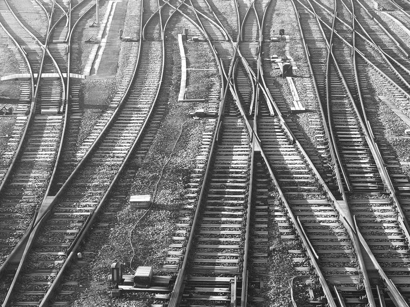
Photo: ID 1014175 © Jean Schweitzer. Dreamstime.com.